
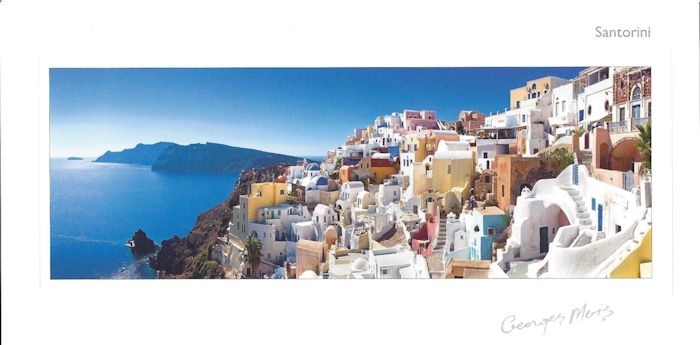
George Meis Postcard of Santorini
Links to Port Pages
Santorini, Italy
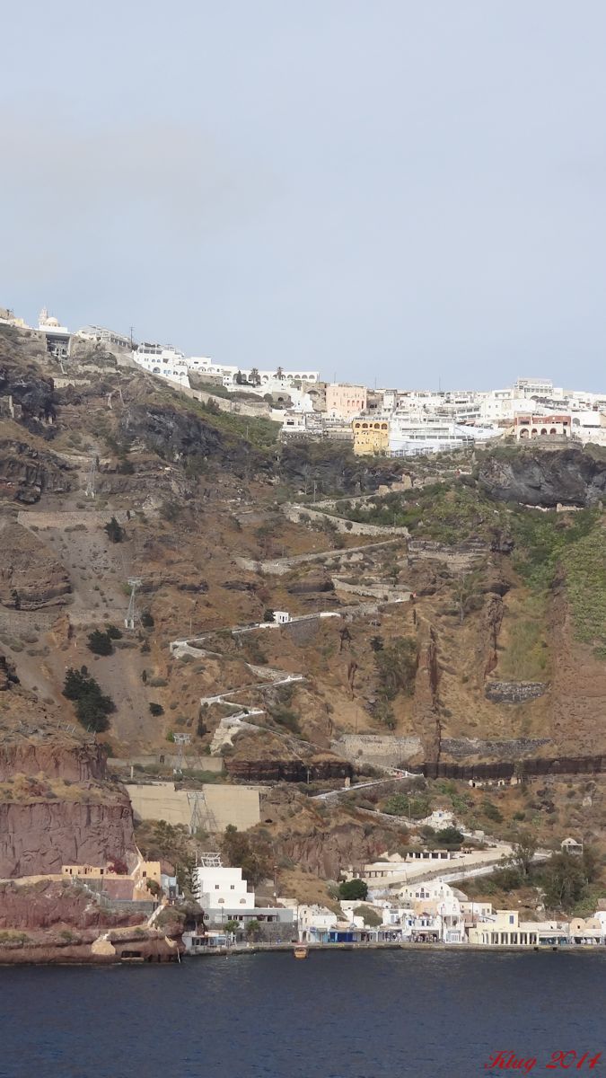
We arrived in the caldera of Santorini early in the morning. While the day was sunny, there was an overcast and haze which remained most of the day. We did not schedule a tour - we wanted to explore on our own. After a nice breakfast in La Terraza we gathered our cameras and took the tender over to the island.
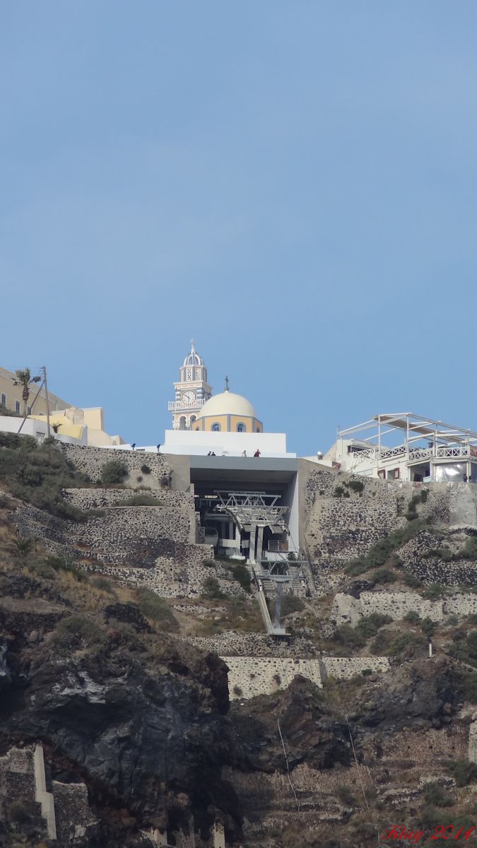
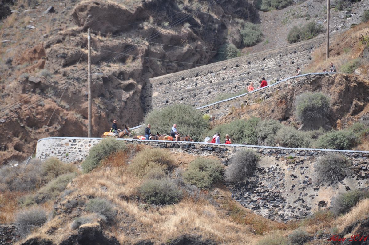
There are three ways to go up the cliffs to the town of Fira - walk the path up for about 30 minutes of hard climbing (umm, nope); ride a donkey up the path (umm, not much better!); or pay 5 euros and ride the cable car up in about 5 minutes (Yep, that's our style!).
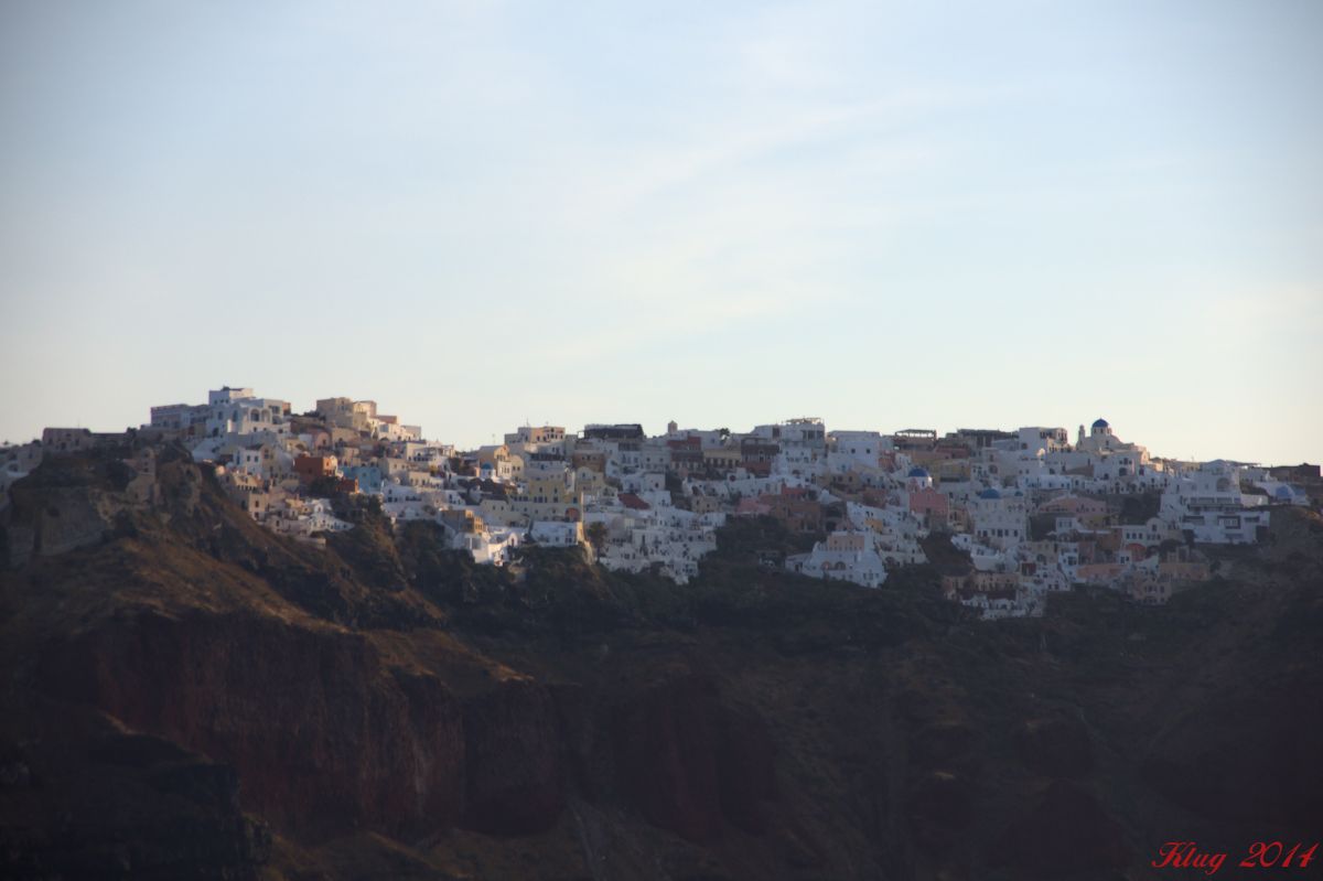
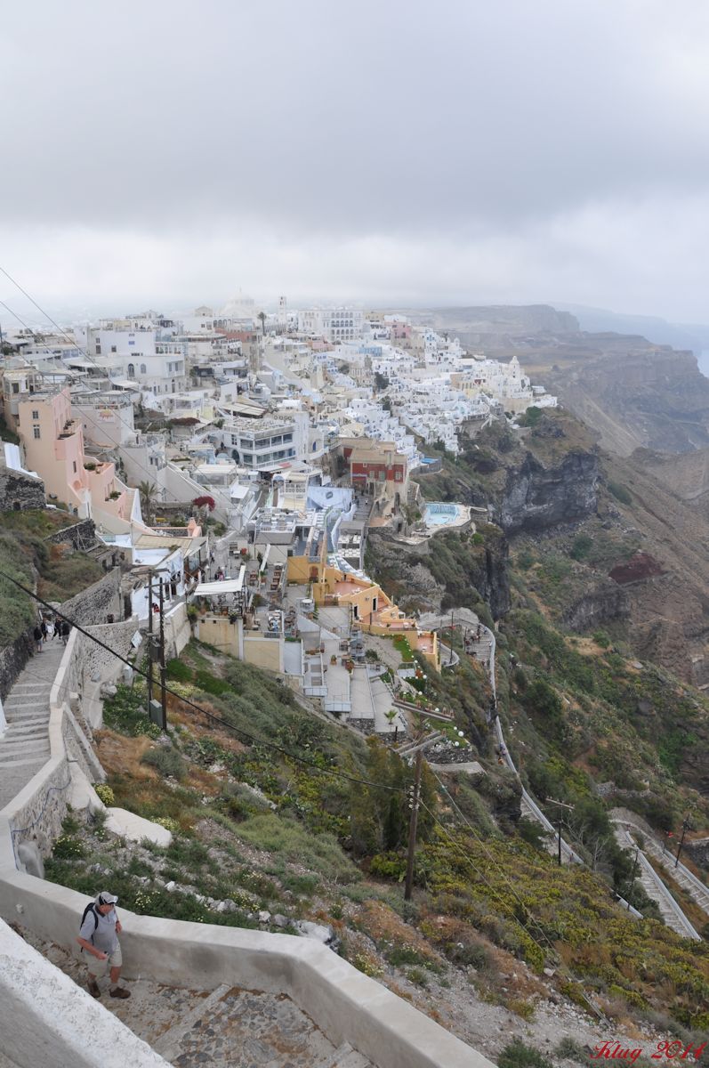
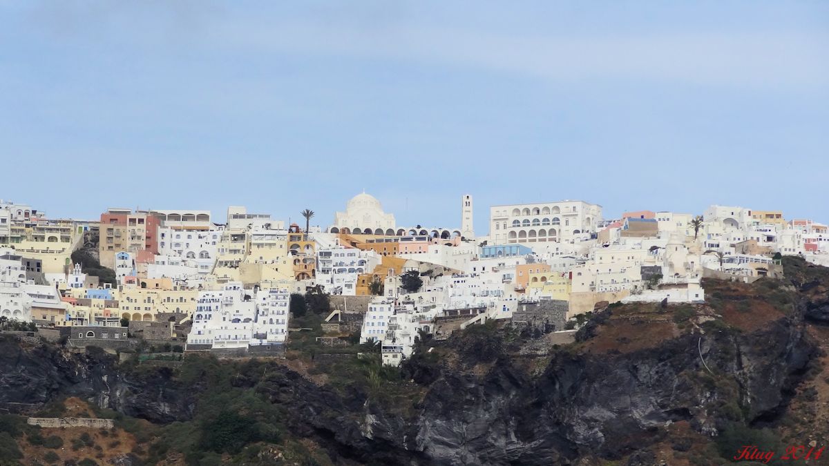
Once we reached the town we wandered along the street facing the caldera and marveled at the view. We wish it had been a clearer day as the view is incredible. After a few pictures we wandered the streets, looked in shops, tried on some greek clothing, went into the Catholic Cathedral of Santorini. Although small, the mosaics are beautiful.
We located a small coffee shop tucked down a cross street. Cappuccino Crema was on the menu so we gave it a try. It was the best cappuccino we ever tasted and ended up being number one on the "Cap List" as we ended up drinking cappucinos in nearly every port we stopped. Since the cafes and bars in most places have free WiFi we would take our Ipads with us and when it was time for a break we located a cafe and enjoyed a couple of cappuccinos and sometimes a small snack. We could check our email and surf the internet a bit which made it much easier once we returned home. We also were able to drop quick texts or emails to family as we traveled. I have the coffee shop marked on the map so when we return in 2015 - that is definately the place we will go for another Cappuccino Crema!
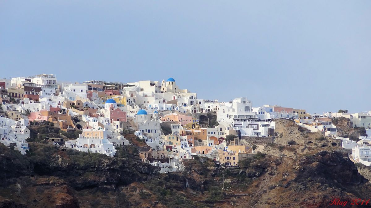
We did not visit Oia, but we heard it is both beautiful and interesting. Santorini is also the site of Akrotiri - a Minoan settlement that has been excavated. So on our next cruise we will need to go see both places on the island!
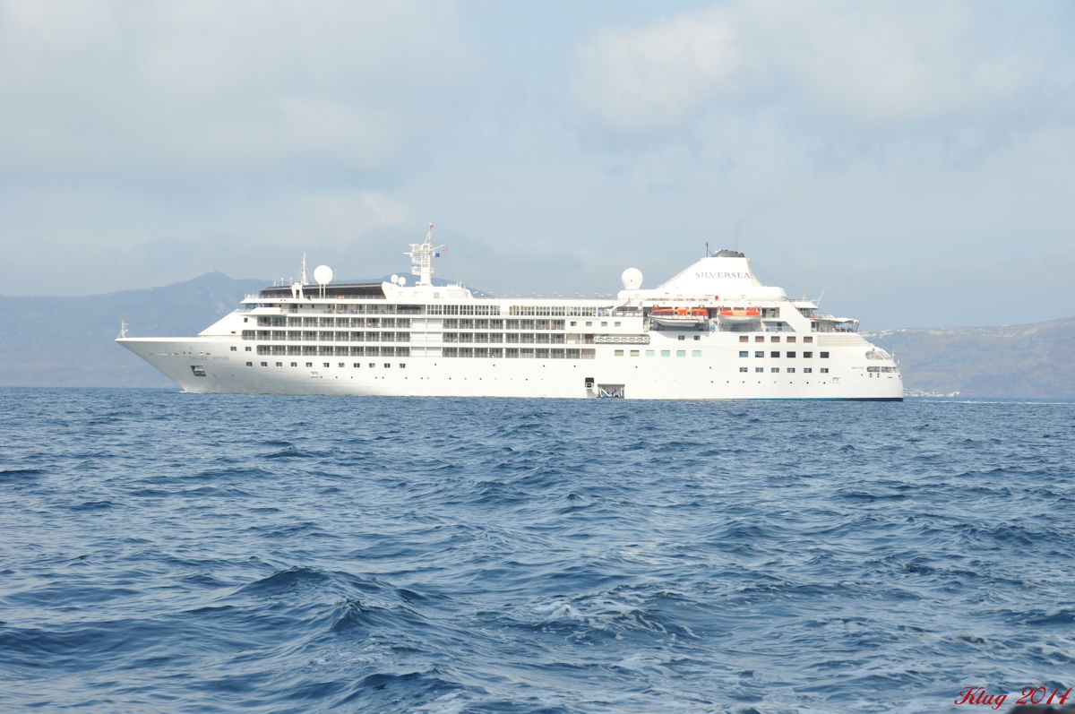
We returned to the ship around 4 pm and prepared for another hosted dinner, this time with Paulina Salinas, the shore concierge manager. Dinner was enjoyable and great conversation. We met several couples that evening who we conversed with a few times throughout the cruise.
On to our next stop - Napflion and our tour to Mycenae!
 |
 |
Arriving in Santorini |
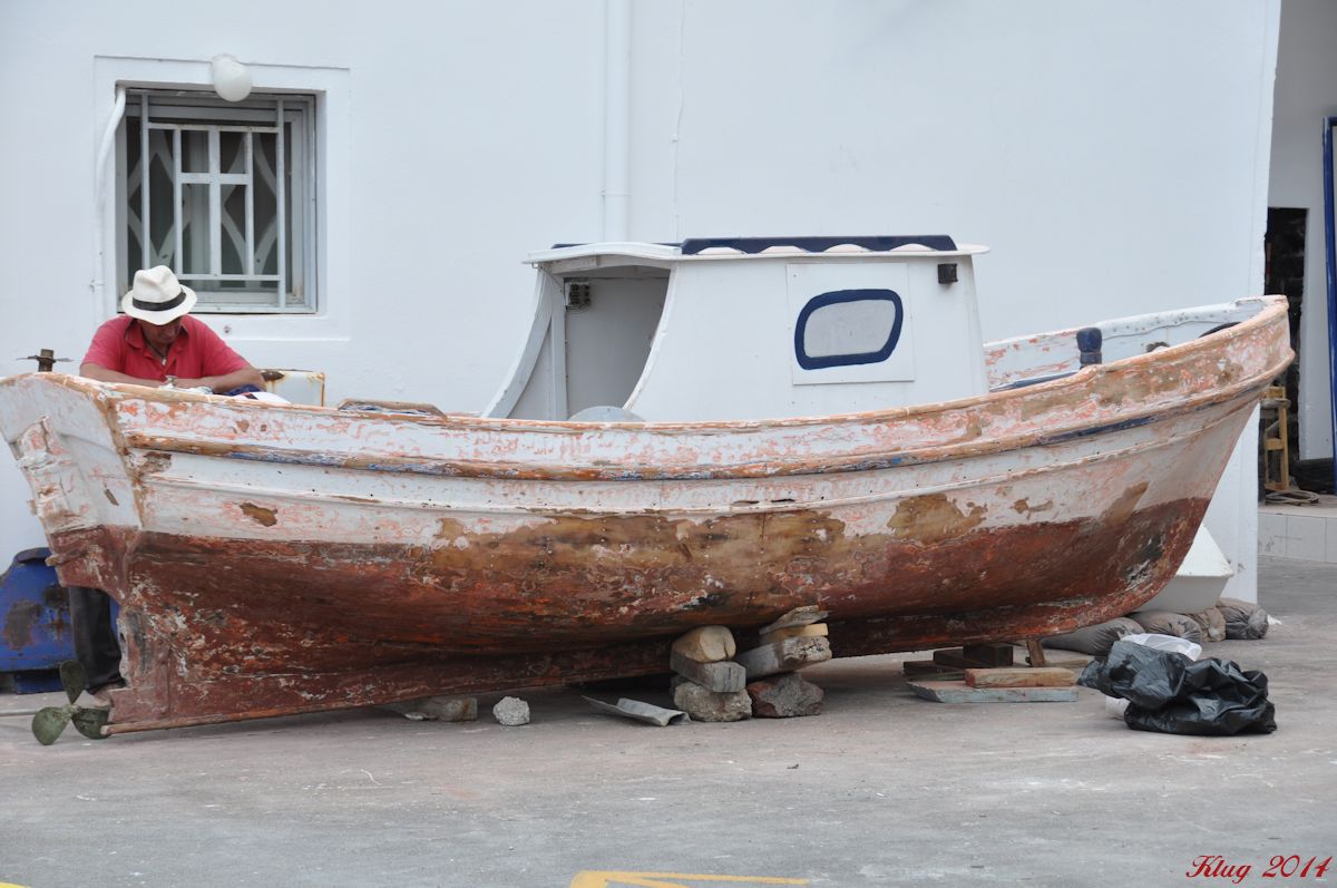
Boat work |
 |
 |
Looking up from the cable car port |
View of the cable cars and path |
 |
 |
Cable Car Fira |
View from the ship |
 |
 |
Donkeys on the path |
View from the top (RK photo) |
Panorama view from the top |
Panorama view - Silver Wind is on the right in the caldera |
 |
 |
Silver Wind - positioning, no anchor |
View of the ship |
 |
 |
Fira |
Fira |
 |
 |
Last view of Fira |
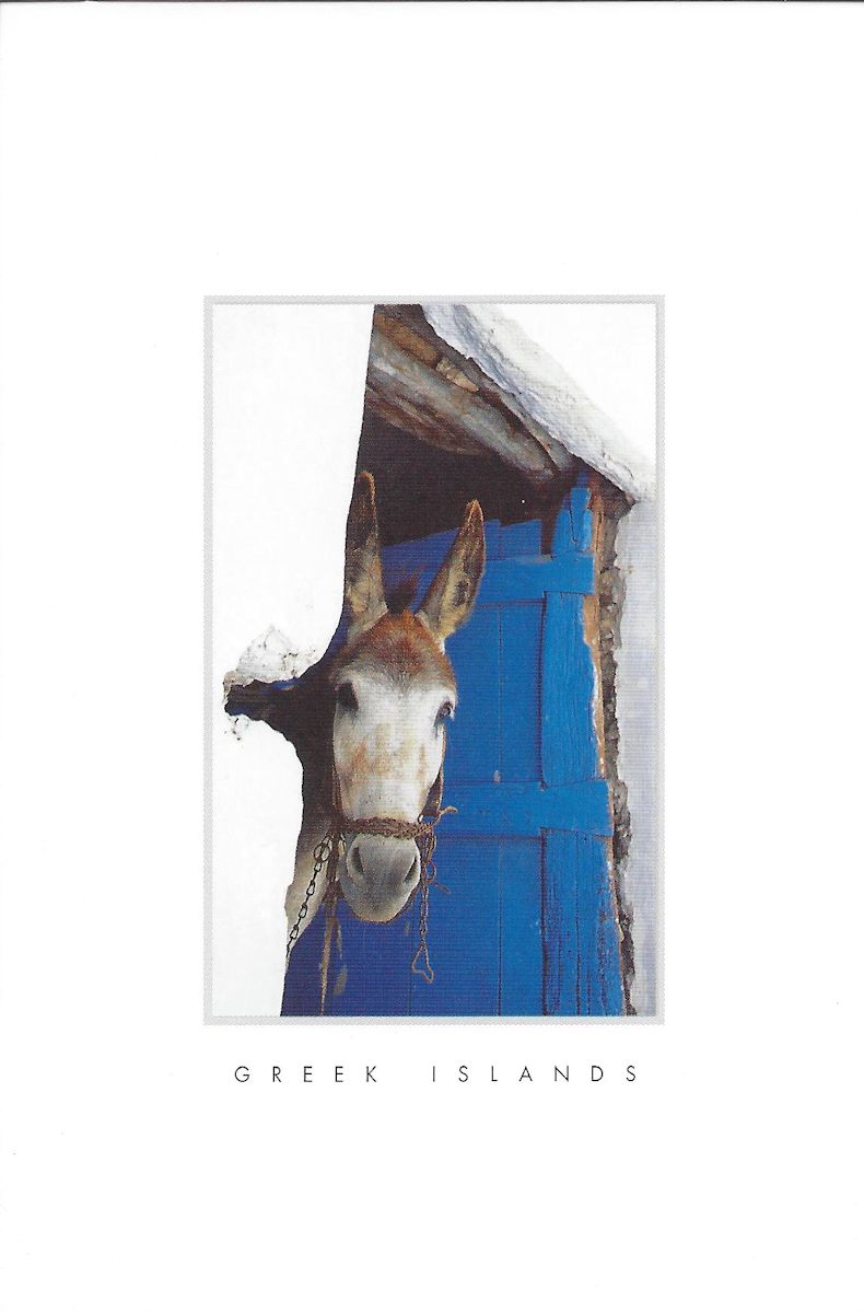
Greek Island Donkey postcard |
 |
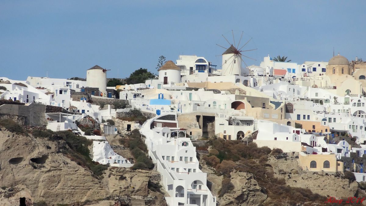 |
Oia |
Oia and the windmill |
![]()
Posts before the cruise
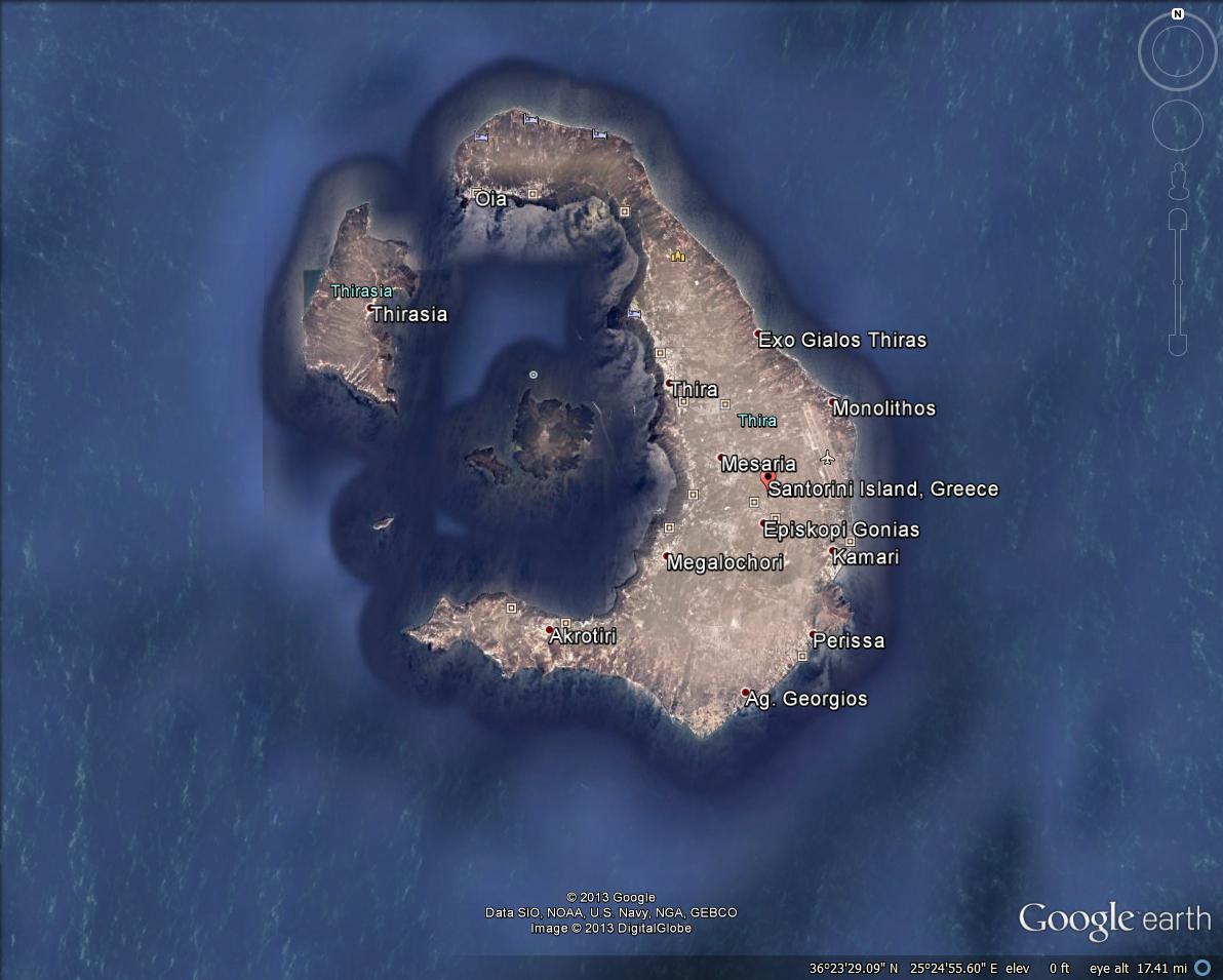
Santorini (Greek: Σαντορίνη, pronounced [sadoˈrini]), classically Thera /ˈθɪrə/, and officially Thira (Greek: Θήρα [ˈθira]), is an island in the southern Aegean Sea, about 200 km (120 mi) southeast from Greece's mainland. It is the largest island of a small, circular archipelago which bears the same name and is the remnant of a volcanic caldera. It forms the southernmost member of the Cyclades group of islands, with an area of approximately 73 km2 (28 sq mi) and a 2011 census population of 15,550. The municipality of Santorini comprises the inhabited islands of Santorini and Therasia and the uninhabited islands of Nea Kameni, Palaia Kameni, Aspronisi, and Christiana. The total land area is 90.623 km2 (34.990 sq mi). Santorini is part of the Thira regional unit.
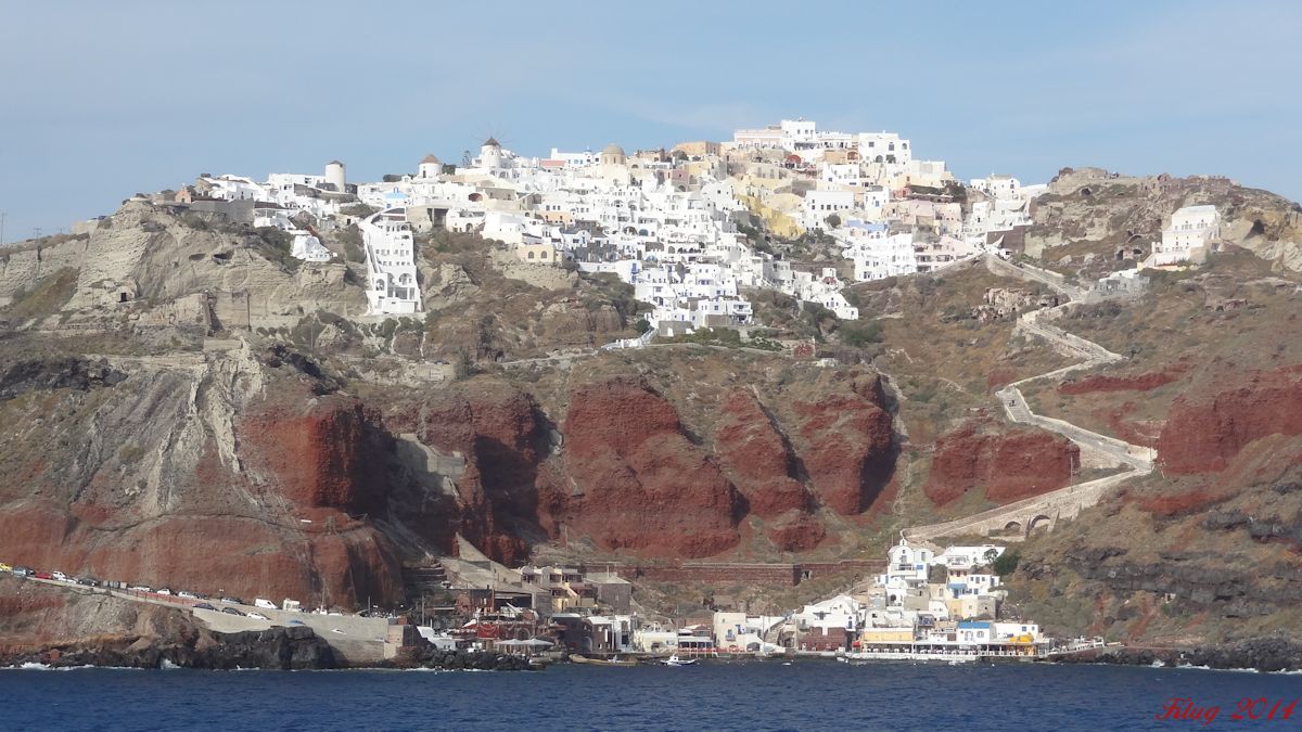
Santorini is essentially what remains after an enormous volcanic explosion that destroyed the earliest settlements on a formerly single island, and created the current geological caldera. A giant central, rectangular lagoon, which measures about 12 by 7 km (7.5 by 4.3 mi), is surrounded by 300 m (980 ft) high, steep cliffs on three sides. The main island slopes downward to the Aegean Sea. On the fourth side, the lagoon is separated from the sea by another much smaller island called Therasia; the lagoon is connected to the sea in two places, in the northwest and southwest. The depth of the caldera, at 400m, makes it possible for all but the largest ships to anchor anywhere in the protected bay; there is also a newly built marina at Vlychada, on the southwestern coast. The island's principal port is Athinias. The capital, Fira, clings to the top of the cliff looking down on the lagoon. The volcanic rocks present from the prior eruptions feature olivine and have a small presence of hornblende.
It is the most active volcanic centre in the South Aegean Volcanic Arc, though what remains today is chiefly a water-filled caldera. The volcanic arc is approximately 500 km (310 mi) long and 20 to 40 km (12 to 25 mi) wide. The region first became volcanically active around 3–4 million years ago, though volcanism on Thera began around 2 million years ago with the extrusion of dacitic lavas from vents around the Akrotiri.
The island is the site of one of the largest volcanic eruptions in recorded history: the Minoan eruption (sometimes called the Thera eruption), which occurred some 3600 years ago at the height of the Minoan civilization. The eruption left a large caldera surrounded by volcanic ash deposits hundreds of metres deep and may have led indirectly to the collapse of the Minoan civilization on the island of Crete, 110 km (68 mi) to the south, through a gigantic tsunami. Another popular theory holds that the Thera eruption is the source of the legend of Atlantis. (From Wikipedia)
 |
![]()
What We Plan to See:
Research and planning underway!
But we may plan to visit the Archaeological Museum with it's displays of pottery, statues, and grave artifacts found at excavations mostly from ancient Thira and Akrotiri, from the Minoan through the Byzantine periods. And possibly visit the Museum of Prehistoric Thera with displays of pots and frescoes from the famed excavations at Akrotiri.
The Akrotiri Excavations recently re-opened. The site at Thera is the best known Minoan site outside of Crete. During the Minoan age the volcano erupted and covered the entire island in ash. The continual eruptions throughout time have caused the caldera shape of the island. Thera is also believed to be "Atlantis" of legend. The ruins are very well-preserved and are comparable to Pompeii. As we visited Pompeii in 2012, we may just have to put this on our list!
Of course the island itself and the white washed buildings that you see in every picture will be fantastic to see for ourselves. So this also may be a place to just get off the ship and wander the town on our own.
![]()